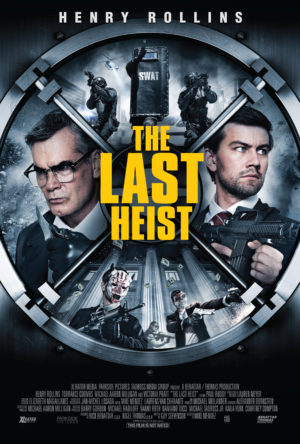
Subscribe

175

Fans

ON FACEBOOK

Search

Email

  • Memphis, TN 38103 U.S.A. Otto 240cf86e-5cad-11dc-8314-0800200c9a66

Facebook

Amazon

Buy Otto a Beer

Currency:

Amount:

Website(Optional):

Get Otto a Gift

My Amazon.com Wish List
Text

21 Dec 2009-12-21 14:08

Twitter Geolocation

Heard of geotagged tweets yet? Not surprised, a lot of my friends seem to have not caught on to it, so I’m writing this in a possibly futile attempt to get them to try it out.

How to add your location to your tweets

1. Turn on Geotagging. To do this, go to your Twitter settings page. Down under the “Location” section is an option to enable geotagging. Turn it on.

Twitter Settings

2. Get a Twitter client that supports Geotagging. These are generally mobile applications. Tweetie 2 for the iPhone added support for it in 2.1. Several other clients support it as well. Find one.

3. Turn it on in your client. How you do this depends on the client, but it can usually be enabled on a per-tweet basis.

Here’s an example of how it works and looks in Tweetie 2 for the iPhone.

First, you type in a new tweet, and pull open the drop down.

Next, you enable the geotag feature, and you'll see a little red pin appear.

You'll see little maps on tweets with locations attached to them.

Click on the map icon for greater detail.

You can do more with your Twitter location too. For example, this website will read your twitter feed and get your latest location, then send it over to Fire Eagle, which is Yahoo’s location service. Fire Eagle can do all sorts of things, but basically it’s just a service that stores your location for other programs to use. So if you want to display your location on your blog, or on Facebook for your friends to see, or anything else you can think of, you can do that, using nothing more than your already existing tweets.

Tags: , , , , ,
Shortlink:

Posted in Geekery, General Spew, Linkery, Thingery | 1 Comment » -

Text

21 Sep 2009-09-21 13:03

Waze – Free iPhone Directions Application

Playing around this weekend, I discovered a neat and fun little app for the iPhone.

A lot of new apps have came out for the iPhone lately that are based around driving directions. TomTom came out with theirs for $100, and Navigon is another popular one that runs $90. But, if you want to try out something a little different, this one is free.

iPhone image

Waze is a free driving directions app, with a twist. Basically, the maps on it are “incomplete”. That is, they’ve got the map data, but like all maps, the data is inaccurate. So, to get the data to be better, they’re enlisting your help.

How do you help? Simple. You use the app in the car, then drive around. As you do so, the GPS will be reading your location and noting that there is indeed a street there. It makes it kinda fun to confirm streets in this way since a little Pac-Man like figure appears, eating dots on the map where you are driving, and giving you “points”. The points aren’t useful for much, except a ranking system with everybody else using the app, but it’s fun nevertheless.

So what else? Well, obviously it’ll do driving directions. However, when I tried it to get to my friend’s place at Cooper-Young fest this last weekend, it was laughably wrong. It suggested an 8 mile trek through ridiculous parts of town for no reason. I drove there the normal route instead, letting it complain that I was “off route” all the way and listening to the Waze-pacman gathering up the points as he munched his way down the road. However, something odd happened then. On the way back, when I turned it on, it knew that route. Investigating today, I’ve found that it really doesn’t like to route people on routes that haven’t been “confirmed” yet very much. So, since I’d confirmed that route already, it picked it for my way home.

But there’s a bonus to all that. By confirming the route, it’s getting more than street maps. It’s also getting average speeds. So it can use that information to give optimal routes, knowing how fast each street tends to be.

iPhone Event Reporting

You can even more than that though. Along the way, you can report events too.

An event is like an auto accident, or a speed trap. Whenever you see one of these, you can touch the report button and report one quickly. If you’re totally stopped in traffic, then you can also type in a short message (it won’t let you do that while moving), and the message will instantly be sent, where other drivers (and their iPhone’s) can see it. Those drivers will then get routed a different way, possibly saving them some time.

Or, even better, somebody else reports a problem, and you get to save some time.

Downsides to the app: Battery life. Like any other GPS app, it sucks the battery right down. You’ll need a car charger to run the thing. Probably a quality iPhone mount too. It does do landscape mode as well, and hidden down in the options is a “3D mode”, which makes the map lay back and look like the more expensive iPhone driving apps, if you prefer that sort of thing. The 2D map is easier to read, to me.

From what I’m reading, Waze has only been around a month or so, and not many people are using it. As far as I can tell, almost nobody in Memphis is using it, since almost all the roads are unconfirmed. But it would be pretty neat if everybody driving around was sharing data like this, what with Memphis traffic being what it is. I sure wouldn’t mind getting routed around half the crap I see on the streets around here.

If you’ve wanted to try out a driving directions app without spending $100 or so, then you cannot beat free. So I highly recommend it. I’m using it all the time now.

Tags: , , , , , , , ,
Shortlink:

Posted in Geekery, General Spew, Placery, Thingery | No Comments » -

Text

25 Aug 2009-08-25 11:56

Google Maps traffic… it needs work.

I always wondered how Google Maps knew traffic conditions. Today, there’s a blog post where they explain it a bit better.

That ain't on an iPhone...

That ain't on an iPhone...

Basically, they simply have all the phones running Google Maps with GPS send back data as to a) where they are and b) how fast they’re moving. Both of which GPS gives you more or less by default.

It’s a clever idea, and I like it, but it fails in a couple of major ways, IMO.

Firstly, when I use Google Maps on my phone, I tend to not leave it open. Google Maps is fine, but it’s not a very good navigation system. It’s just a map. A real navigation app is worlds better. I recently got Navigon Mobile Navigator on the new iPhone, and it’s pretty slick. Thinking about a dashboard mount for it now, actually.

Secondly, this system relies on a lot of people having Google Maps open and running and sending back data. If nobody with Google Maps running has been on your street recently, you get no information.

What Google really needs to do is to open it up as an API. Let other navigation system manufacturers both send and receive traffic data from the Google Maps system. It doesn’t have to be complex.

Any good navigation app knows your location and speed, so a simple way to send that info could be made easily enough. The problem, of course, is allowing third parties to use the data.

Google Maps works in layers of images, which is one of its major shortcomings, IMO. The street views are images. The terrain are images. Just big sets of tiles that get displayed next to each other. And I’m almost certain that this traffic thing is just another set of images they’re generating or updating. For navigation providers that use 3d views and such, they don’t need that stuff in the form of images, they need it in the form of data. What streets are busy? How can that information be used to improve the navigation? Etc.

Google is generally pretty good at opening up their APIs to third parties. However, they’re generally not good at providing data in different forms. Most of their APIs are “this is what we use, if you need something else we don’t have it” sort of thing. Hopefully, the Google Maps team will see the light here and realize that to get good data, you have to give good data, and start pushing in that direction. Because open traffic data would be pretty cool for everybody.

Tags: , , , , , , , ,
Shortlink:

Posted in Geekery, General Spew, Linkery, Programmery, Thingery | 1 Comment » -

Text

29 May 2009-05-29 11:17

Cameron’s house is up for sale

Tags: , ,
Shortlink:

Posted in General Spew, Linkery, Placery, Thingery | 1 Comment » -

Text

2 Jan 2009-01-02 09:32

Spotted in Savannah

Spotted in Savannah, originally uploaded by Otto42.

Spotted this one early in the trip. Too early, in point of fact, to actually drink Jager.

Tags: , ,
Shortlink:

Posted in General Spew, Placery, Thingery | 1 Comment » -

Text

8 Aug 2008-08-08 10:38

Lightning in Slow Motion

This ranks among one of the coolest videos I’ve ever seen.

Yeah. Fuckin’ metal.

Found on Today’s Big Thing.

Tags: , ,
Shortlink:

Posted in General Spew, Thingery | 1 Comment » -

Text

2 Jul 2008-07-02 16:09

Fashion gone berserk

Okay, this is just ludicrous.

Too lazy to paint a house yourself?

Too lazy to paint a house yourself?

That’s right kiddies, JCrew sells pre-paint stained jeans. For those people too lazy to paint a house, now you can look like you’ve actually been working too, but without all that pain in the ass “labor”.

I understood the patched jeans fad. The scuffed torn thing, I got. The wrong size thing was weird to me, and god help me I even understand stone-washed. But this is simply too far out there for me. Not because of the look, although they look terrible, but because of the price.

Those jeans cost $285.

That’s right. Take one $60-$80 pair of jeans, add $1 worth of white paint, and charge $285 for it.

Note the salesmanship tactics they use in the description. Emphasis is mine:

A hand-crafted collector’s item in authentic selvedge cotton denim from one of Japan’s oldest and most renowned mills. We spend hours on each pair to create a unique jean for the most discerning denim connoisseur, so we have only a handful available—and no two are quite alike. Each one is made with denim woven on the original 100-year-old narrow looms. Each pair is stonewashed, hand-distressed, hand-splattered with paint and hand-finished, giving it the kind of character only individual attention can impart. Button fly. Traditional five-pocket styling, with reinforced back pockets. Import. Machine wash. Catalog/jcrew.com only.

My questions about this copy are two-fold:

  1. Who the hell considers themselves to be a “discerning denim connoisseur”?
  2. I wonder if this sort of sales pitch really obscures the fact that you’re paying damn near $300 for a pair of pre-ruined jeans?
Tags: , , , ,
Shortlink:

Posted in Linkery, Thingery | 5 Comments » -

Text

28 Apr 2008-04-28 13:32

Beer festivals are a wonderful invention…

How can you go wrong with a beer festival?

I mean, it’s truly a brilliant idea to start with. You take about 5000-7000 people, pack them into a park area roughly the size of a city block, then give them unlimited free beer for a few hours. Taster glasses, of course, because we’re not here to get drunk but to try new and different brews.

So I went to the Raleigh Beer festival this weekend, and tried, oh, about 70-ish of the beers that were available. Lots of local brews, which I was happy with. I did not know North Carolina had so many microbreweries, but there were freakin’ dozens of them represented there.

The entire crew at the Raleigh Beer Festival

Met some new people, had dozens of people compliment me on my choice of t-shirt (good choice dad!), and had a lot of quality brews.

Notably good was the beer from Top of the Hill in Chapel Hill, NC. Their Blueberry Wheat was excellent, and I quite liked the Old Well White too. The Leaderboard Lager was quite good as well, albeit a very plain and simple beer. Something you could drink a lot of, a quality lager. I sampled most of their beers, and those really stood out to me.

The Foothills brewery from Winston-Salem was excellent as well. I worked my way through their entire lineup that was there, and it was very good all around. The Pilot Mountain Pale Ale was extremely good for a simple brew, and their IPAs were awesome as well. The Hoppyum was quite hoppy in particular, but the double IPA that they had was extreme in this respect. I like IPA’s, but after a few of them I feel like I’ve been chewing on grass for a while, so I appreciated their Pale Ale a bit more. Also, I’d been to the Dogfish Head booth a number of times already, and their 90 minute IPA had already done a number on me there.

Mimosas The next day we got mimosas.

The girls (and Rob) got theirs with pomegranate juice. I needed my OJ fix a bit too much for that sort of thing.

Also, note to self, cherries have hard pits in them that are not tasty to crunch.

Anyway, good time all around. Would have been perfect if Northwest had not screwed me over on the flight home to the tune of 3.5 hours worth of delay, but still I had a good time. Rob and Mandy’s place is awesome, and I hope to go back sometime soon. If only to visit Top of the Hill and try all the rest of the excellent beers that I missed out on this trip. Plus, gotta try that pool out. :)

Tags: , , , , , , , , , ,
Shortlink:

Posted in General Spew, Placery, Thingery | 2 Comments » -

Text

15 Apr 2008-04-15 14:26

Going to miss the zombies!

Dang! Now I find out that I’m gonna miss the zombies too!

Few posts back I relayed that I was going to a beer festival weekend after next weekend. Today, Paul posted more information about the big zombie attack … and it’s scheduled for that Friday.

I saw the zombies last year when they did it. They come down Beale Street, and then make a left onto Main and come down to right around where I live. It was a lot of fun to watch last year, but a bit chilly out and so there was not a lot of people out on the streets. Since they do it during the South Main Art Trolley Tour, and it’s probably going to be nice and warm out, then this seems like it will be a good one. You know, lots of carnage, riots, random destruction… followed by an afterparty.

I’d even be interested in getting all zombied up myself if I was going to be here. Maybe I could be zombie bum.

Oh well, I hope Paul gets a lot of good pictures.

Tags: , , , ,
Shortlink:

Posted in General Spew, Thingery | Comments Off -

Text

29 Feb 2008-02-29 10:49

Bacon cups

You know, I’ve always liked salads, but thought they were too healthy for my lifestyle. How can I make a salad unhealthy for me?

The usual answer, of course, is the taco salad. It’s a salad in a big flour-based bowl, but topped with the contents of about 6 tacos worth of meat and cheese and such. But is that really enough? Is that really unhealthy enough for my inactive lifestyle?

Of course not. Enter: Bacon Cups.

Bacon cups

Yes, a cup made of bacon. What better thing could you possibly make edible utensils out of than bacon?

The site called “not martha” gives details on exactly how to do this. The scheme is simple and straightforward, and I imagine that if you wanted to scale this up to a taco salad sized bowl, then it would be quite possible.

On the other hand, I’m considering this sized container as a possible holder for cheese dip, for that ultimate party snack food. Although I am somewhat concerned about leak-through. You’d have to use quite a lot of bacon to be sure that it was sealed enough to hold thick liquids like dip.. Or ranch.

If you do scale it up to taco salad, then don’t forget the bacon salt.

Tags: , , , , ,
Shortlink:

Posted in General Spew, Thingery | 4 Comments » -